
Un momento, por favor
Un momento, por favor
American · 1840–1882
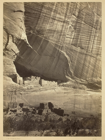 Ancient Ruins in the Cañon de Chelle, N.M. In a niche 50 feet above present Cañon bed.Timothy O'Sullivan · 1873
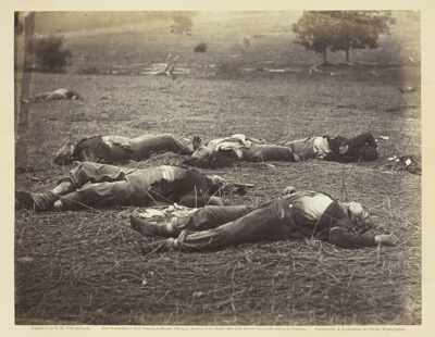 Field Where General Reynolds Fell, GettysburgTimothy O'Sullivan · July 1863
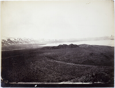 Mono Lake, Volcano, 13,000 FeetTimothy O'Sullivan · 1868
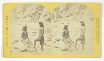 Types of Mojave Indians. This tribe inhabits the region of the lower Colorado, or western Arizona.Physically, they are the finest specimens in all the West, many of the males attaining to the height of 6 feet, No. 5 from the series "Geographical Explorations and Surveys West of the 100th Meridian"Timothy O'Sullivan · 1871
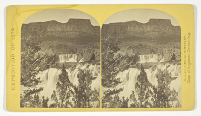 Shoshone Falls, Snake River, Idaho, looking through the timber, and showing the main fall, and upper or "Lace Falls", No. 49 from the series "Geographical Explorations and Surveys West of the 100th Meridian"Timothy O'Sullivan · 1874
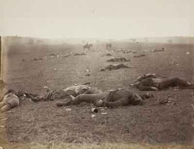 A Harvest of Death, Gettysburg, PennsylvaniaTimothy O'Sullivan · July 1863
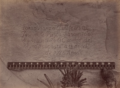 Geographical & Geological Explorations & Surveys West of the 100th MeridianTimothy O'Sullivan · 1871/73
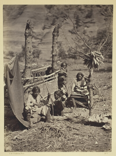 Aboriginal Life Among the Navajoe Indians, Near Old Fort Defiance, N.M.Timothy O'Sullivan · 1873
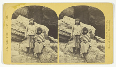 Navajo Brave and his Mother. The Navajo were formerly a warlike tribe until subdued by U.S. Troops, in 1859-60. Many of them now have fine flocks, and herds of horses, sheeps and goats, No. 29 from the series "Geographical Explorations and Surveys West of the 100th Meridian"Timothy O'Sullivan · 1873
 Geographical Explorations and Surveys West of the 100th MeridianTimothy O'Sullivan · 1871/74
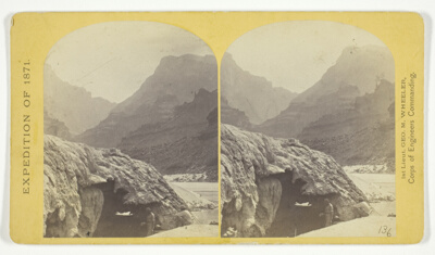 Grotto Spring, Grand Cañon, Colorado River, No. 4 from the series "Explorations and Surveys West of the 100th Meridian"Timothy O'Sullivan · 1871
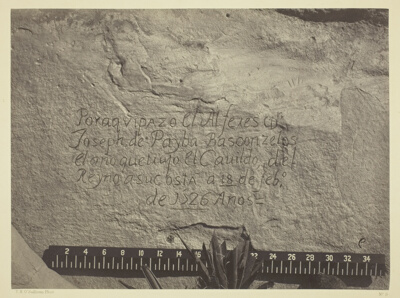 Historic Spanish Record of the Conquest, South Side of Inscription Rock, N.M.Timothy O'Sullivan · 1873
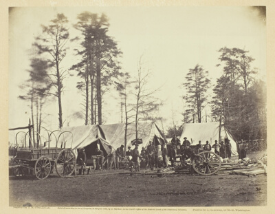 Army Repair ShopTimothy O'Sullivan · February 1864
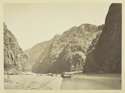 Black Cañon, looking above from Mirror BarTimothy O'Sullivan · 1871
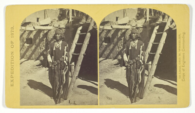 War Chief of the Zuni Indians, No. 20 from the series "Geographical Explorations and Surveys West of the 100th Meridian"Timothy O'Sullivan · 1873
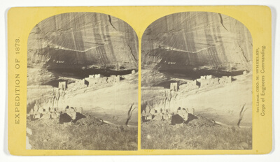 Ruins in Cañon de Chelle, N. M., in a cavity in the wall, 60 feet above present bed of Cañon. Height of walls about 700 feet. The present race of Indians know nothing of the age of these buildings of who occupied them, No. 21 from the series "Geographical Explorations and Surveys West of the 100th Meridian"Timothy O'Sullivan · 1873
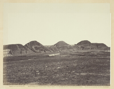 Three First Traverses on Land End, Fort Fisher, North CarolinaTimothy O'Sullivan · January 1865
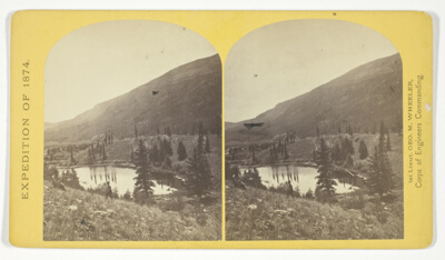 Beaver Lake, Conejos Cañon, Colorado, 9.000 feet above sea-level, and 30 miles from mouth of Cañon, No. 35 from the series "Geographical Explorations and Surveys West of the 100th Meridian"Timothy O'Sullivan · 1874
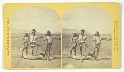 Apache Indians, as they appear ready for the war-path, No. 33 from the series "Geographical Explorations and Surveys West of the 100th Meridian"Timothy O'Sullivan · 1873
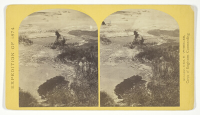 One of the group of Pagosa Hot Springs, showing incrustation on the surface. Much prized by the Indians and miners on account of supposed healing qualities. Principal mineral element, Sulphate of Soda, No. 38 from the series "Geographical Explorations and Surveys West of the 100th Meridian"Timothy O'Sullivan · 1874
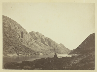 Iceberg Cañon, Colorado River, Looking AboveTimothy O'Sullivan · 1871
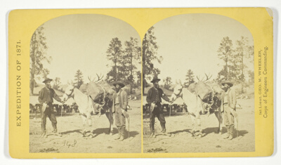 Mountain transportation. Pack mule, Pack and Packers, No. 7 from the series "Geographical Explorations and Surveys West of the 100th Meridian"Timothy O'Sullivan · 1871
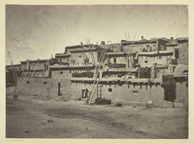 Section of the South Side of Zuni Pueblo, N.M.Timothy O'Sullivan · 1873
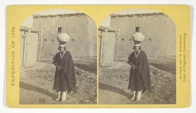 Zuni Indian Girl, with water olla, No. 17 from the series "Geographical Explorations and Surveys West of the 100th Meridian"Timothy O'Sullivan · 1873
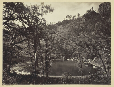 Apache Lake, Sierra Blanca Range, ArizonaTimothy O'Sullivan · 1873
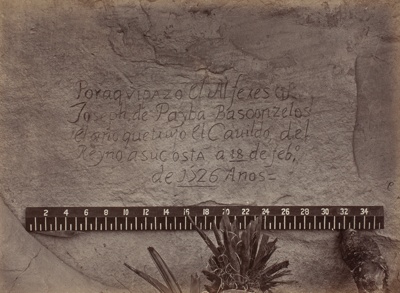 Historic Spanish Record of the Conquest, South Side of Inscription Rock, N.M.- No. 3., from the album "Geographical & Geological Explorations & Surveys West of the 100th Meridian," vol. 1Timothy O'Sullivan · 1873
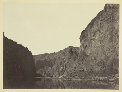 Black Cañon, Colorado River, looking below from Big Horn CampTimothy O'Sullivan · 1871
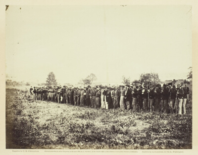 Group of Confederate Prisoners at Fairfax Court-HouseTimothy O'Sullivan · June 1863
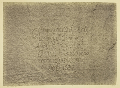 Historic Spanish Record of the Conquest, South Side of Inscription Rock, N.M. Geographical & Geological Explorations & Surveys West of the 100th Meridian. Expedition of 1873. -Lieut. Geo. M. Wheeler, Corps. of Engineers, Commanding.Timothy O'Sullivan · 1873
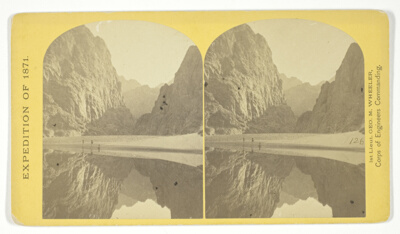 View down Black Cañon, from Mirror Bar. The walls repeated by reflection, No. 3 from the series "Geographical Explorations and Surveys West of the 100th Meridian"Timothy O'Sullivan · 1871
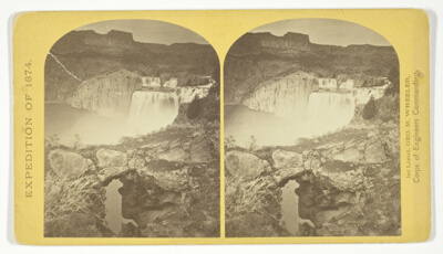 Shoshone Falls, Snake River, Idaho. Gorge and natural bridge, in the fore-ground, No. 50 from the series "Geographical Explorations and Surveys West of the 100th Meridian"Timothy O'Sullivan · 1874
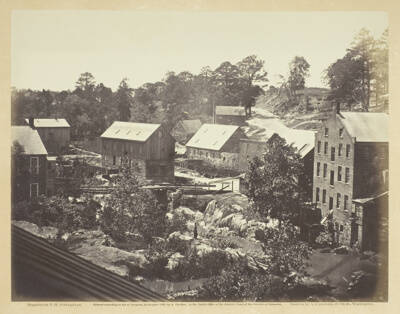 View on the Appomattox RiverTimothy O'Sullivan · May 1865
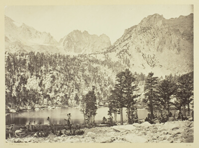 Alpine Lake, in the Sierra Nevada, CaliforniaTimothy O'Sullivan · 1871
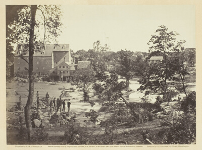 Johnson Mill, Petersburg, VirginiaTimothy O'Sullivan · May 1865
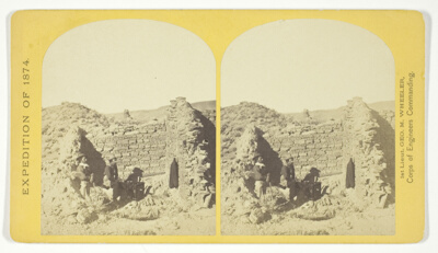 Characteristic ruin, of the Pueblo San Juan, New Mexico, on the north bank of the San Juan River, about 15 miles west of the mouth of Cañon Largo. The present race of Indians know nothing of when or by whom these buildings were constructed. The ruin is about 350 feet square, and built of natural stone, joined together by a mud cement, No. 43 from the series "Geographical Explorations and Surveys West of the 100th Meridian"Timothy O'Sullivan · 1874
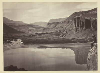 Looking Across the Colorado River to the Mouth of Paria CreekTimothy O'Sullivan · 1873
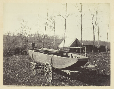 Pontoon Boat, Brandy Station, VirginiaTimothy O'Sullivan · February 1864
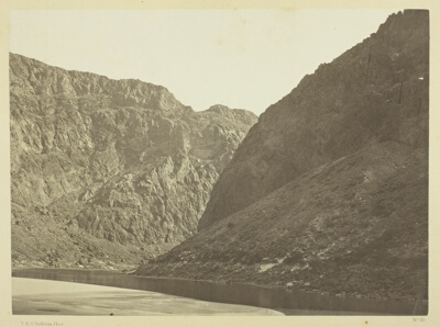 Entrance to Black Cañon, Colorado RiverTimothy O'Sullivan · 1871
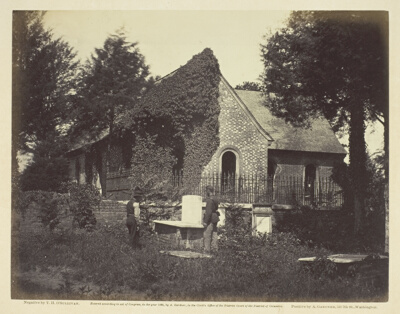 Blandford Church, Petersburg, VirginiaTimothy O'Sullivan · April 1865
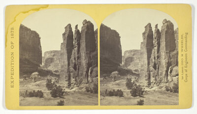 Camp Beauty, Canñon de Chelle; walls 1.200 feet high, width of Cañon at this point about one fourth of a mile. This view shows the perpendicular effect wrought by the action of floods. The Artist of the Expedition, Mr. Wyant, of New York, made a study of this scene with the intention to paint it as a characteristic Canon view, No. 25 from the series "Geographical Explorations and Surveys West of the 100th Meridian"Timothy O'Sullivan · 1873
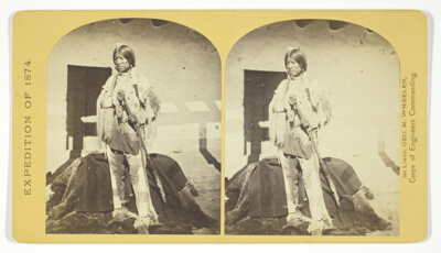 Shee-zah-nan-tan, Jicarilla Apache Brave in characteristic Costume, Northern New Mexico, No. 42 from the series "Geographical Explorations and Surveys West of the 100th Meridian"Timothy O'Sullivan · 1874
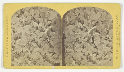 Sensitive PlantTimothy O'Sullivan · 1870
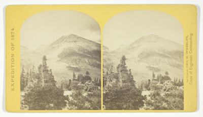 Baldy Peak, Cerro Blanco Mountains, Colorado, 14.234 feet above sea-level. Limit in altitude of vegetation about 11.000 feet, No. 46 from the series "Geographical Explorations and Surveys West of the 100th Meridian"Timothy O'Sullivan · 1874
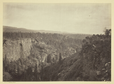 North Fork Cañon, Sierra Blanca Creek, ArizonaTimothy O'Sullivan · 1873
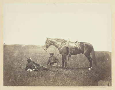 The HaltTimothy O'Sullivan · May 1864
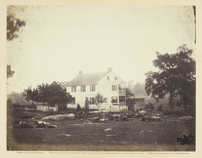 Trossell's House, Battle-Field of GettysburgTimothy O'Sullivan · July 1863
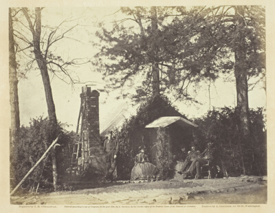 Camp Architecture, Brandy Station, VirginiaTimothy O'Sullivan · January 1864
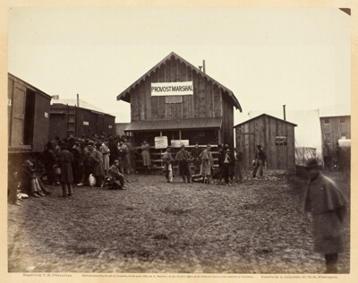 Provost Marshal's Office, Aquia CreekTimothy O'Sullivan · February 1863
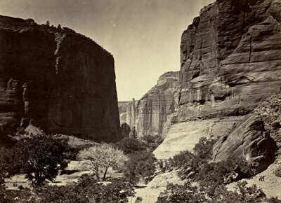 Head of Cañon de Chelle, Looking Down. Walls about 1200 feet in heightTimothy O'Sullivan · 1873
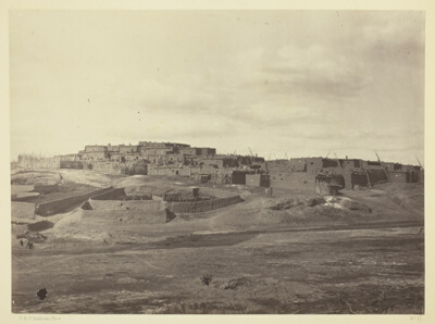 Indian Pueblo, Zuni, N.M. View from the SouthTimothy O'Sullivan · 1873
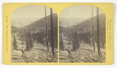 Cañon, Valley of the Conejos River, looking south from vicinity of "Lost Lakes", No. 36 from the series "Geographical Explorations and Surveys West of the 100th Meridian"Timothy O'Sullivan · 1874
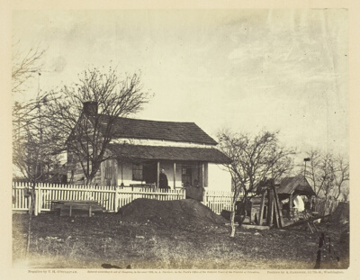 Head-Quarters Major General George G. MeadeTimothy O'Sullivan · July 1863
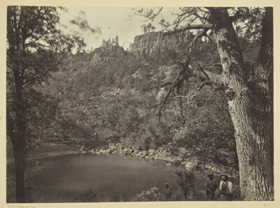 View on Apache Lake, Sierra Blanca Range, ArizonaTimothy O'Sullivan · 1873
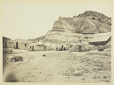 Water Rhyolites, Near Logan Springs, NevadaTimothy O'Sullivan · 1871
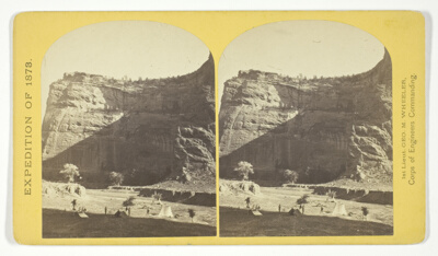 Circle Walls, Cañon de Chelle. Here the Cañon bends from an easterly direction nearly due north, the walls maintaining a perpendicular height of about 1.200 feet, No. 22 from the series "Geographical Explorations and Surveys West of the 100th Meridian"Timothy O'Sullivan · 1873
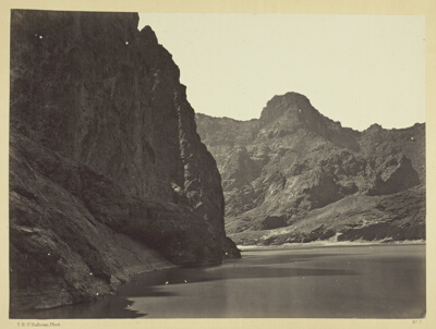 Black Cañon, Colorado River, looking below near Camp 7. Explorations in Nevada and Arizona, Expedition of 1871. Lieut. Geo. M. Wheeler, Com'd'g.Timothy O'Sullivan · 1871
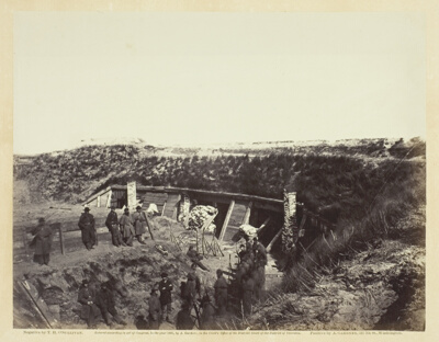 The Pulpit, Fort Fisher, N.C.Timothy O'Sullivan · January 1865
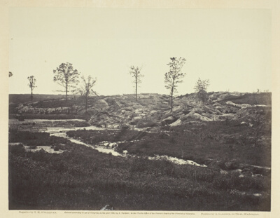 Interior View of the Confederate LineTimothy O'Sullivan · May 1865
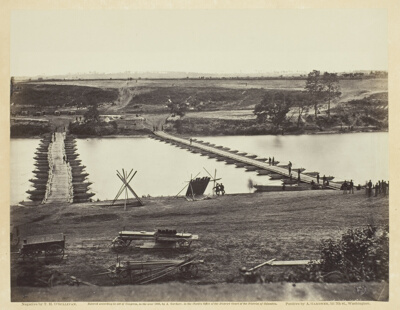 Pontoon Bridge Across the RappahannockTimothy O'Sullivan · May 1863
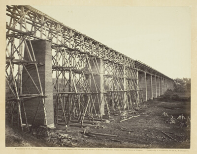 High Bridge Crossing the Appomattox, Near FarmvilleTimothy O'Sullivan · 1865